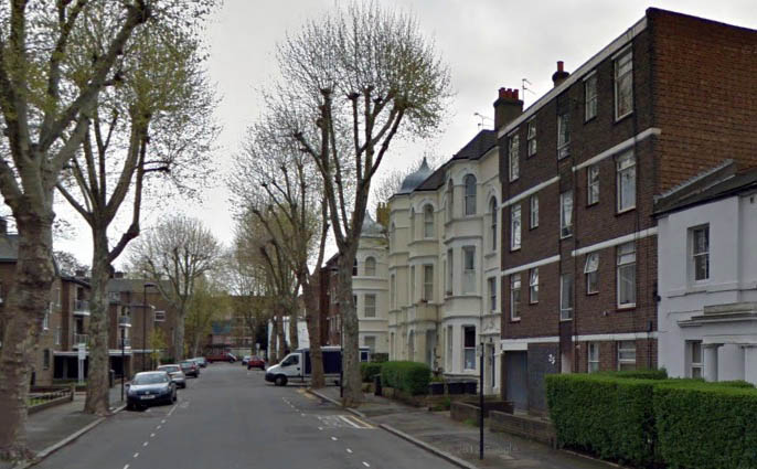
An Overview
Southey Road sits between Brixton Road and Hackford Road with Cranworth Gardens joining it to the south, it was first built in the 1820’s. Southey Road was originally named St Ann’s Street and then St Ann’s Road, the name also applied to Hackford Road until the late 1860’s. The reference to St Ann is probably due to the fact that parts of this street were once owned by the church, North Brixton chuch hall stood where Mercury Court now stands.
This short street is actually one of the older streets in the vicinity, the first cottages erected around 1830, two of which remain. From it’s first appearance Southey Road stood as a peaceful and somewhat rural lane with only a few cottages and small dwellings lining either side. It stood in this manner until 1899 when Cranworth Gardens was built running south from the centre of Southey Road, the new mansion flats that lined this new street also spilled out onto the middle of Southey Road where they still stand today. A quick sample of the the census of 1901 shows a ‘shipping clerk’, a ‘medical box maker’, a ‘journalist and author’ and several people ‘Living on their own means’. At some point after 1920 this road was renamed Southey Road. It is likely that this is in commemoration of English Romantic poet Robert Southey who in 1793 stayed with his parents on ‘Brixton Causeway’ later to be known as Brixton road, which adjoins Southey Road.
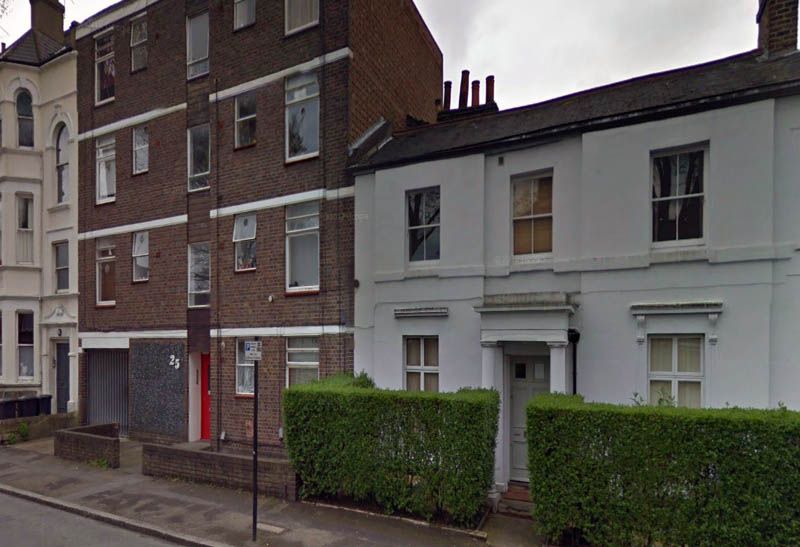
Above – the mish-mash of housing cheek by jowl on Southey Road.
The next big change to Southey Road came courtesy of the bombs of WW2, damage varied from slight to total destruction, prompting the demolition of all buildings on the north side of the street and some to the south including North Brixton Hall. The space left behind by the demolition served as an excellent playground for local children for most of the 1950’s while Lambeth council decided what to do with the area. John Morrissey once lived in Morat Street and remembers the space on the north side of Southey Road (he refers to it as St Ann’s Street in the extract below) he says:
‘Early memories take me back to the bomb sites on the corner of Hackford Road and St Ann’ Street where I remember the fireworks on bonfire night where crowds of local people used to gather. In those days or maybe a few years later we used to be able to get into the cellar of the bombed house on the corner of St Ann’s Street’
Lambeth council finally made their mind up in 1954 and on the rather large space now cleared between Southey Road and Mowll Street they decided to build the Caldwell Gardens estate. The estate is built in blocks, each rather bizarrely named after a Greek god, all except Jessie Wood Court. This old street now stands today with 1830’s cottages next to early Edwardian mansion flats all facing a rather drab 1950’s council estate, it has however managed to retained it’s quiet and peaceful atmosphere despite the years of change.
Southey Road in Photographs then and now…
1905 – Below
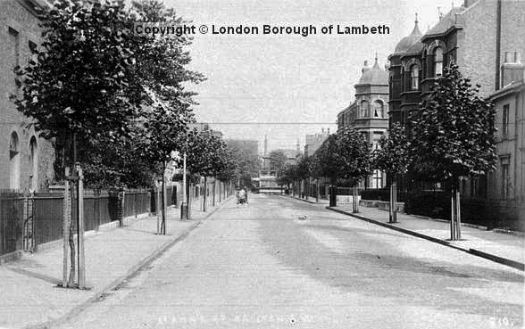
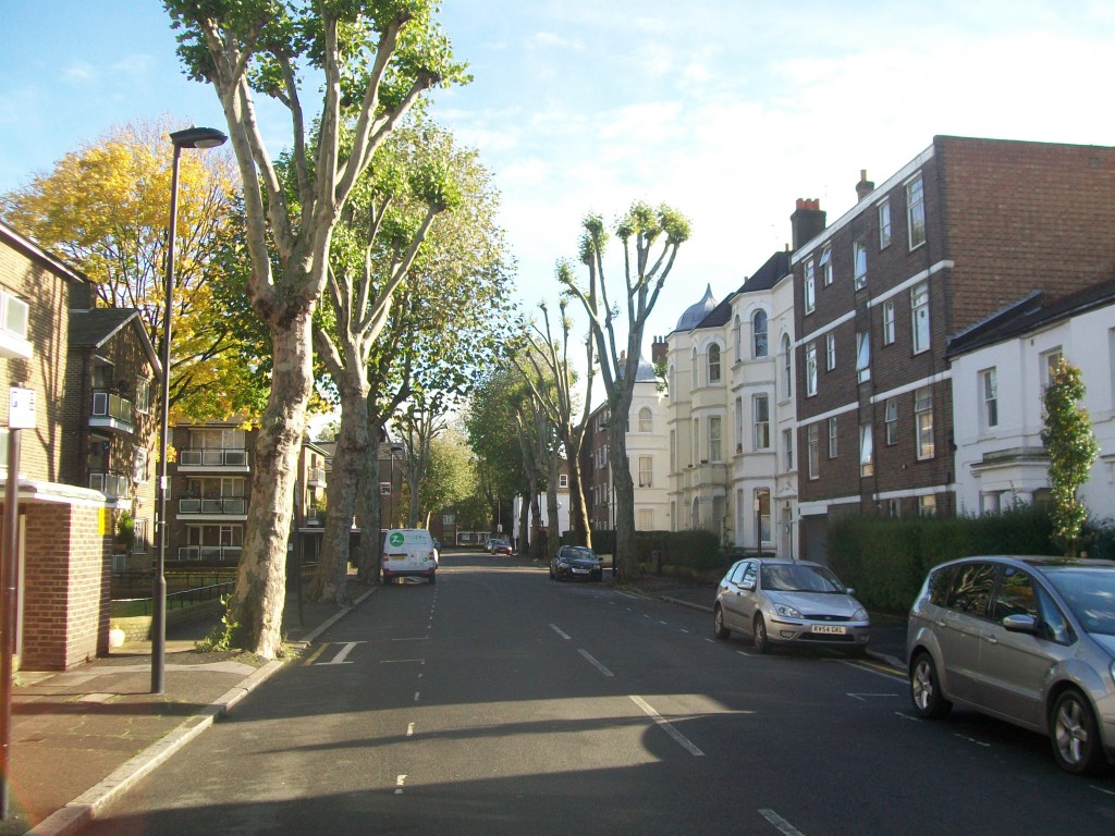
2012 – Below
1920 – Below
Southey Road in Maps…
1809
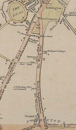
The map above is “Laurie and Whittle New Map of London with its Environs, almost all of the streets that we know so well had not yet been built including Southey Road, the area was mostly open countryside.
1820
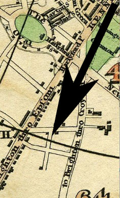
“Pigot & Co.’s Metropolitan Guide & Miniature Plan Of London from 1820″ shows the area eleven years later. I have added an arrow pointing to the first appearance of Southey Road on a map. Along with the surrounding streets it is unnamed at this point.
1837
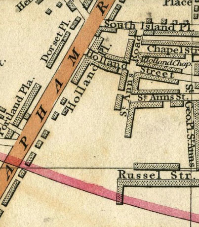
“Cary’s New Plan Of London And Its Vicinity” shows the area another twenty eight years later in 1837. The unnamed shape on the map 17 years earlier now bears a name, St Ann’s Street, whilst Hackford Road is labelled St Ann’s Road.
1844
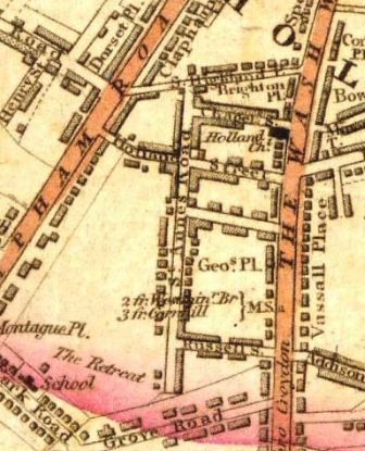
Laurie’s Map of London shows Southey Road 7 years on from the previous map. It was too small for the cartographer to bother labelling.
1861
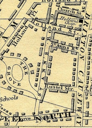
This is Cross’s New Plan of London 1861.
1876
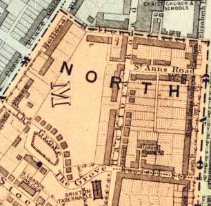
The map above is a Lambeth Ward Map from 1876 showing the division between the Vauxhall Ward (light blue) and the North Brixton Ward (pink).
1898
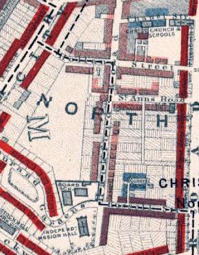
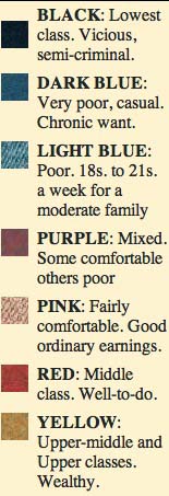
Charles Booth’s Map of London Poverty research took him to Southey Road in 1895. The Map above is from 1898 and shows how Booth graded the street. The key to what the colours mean can be seen to the right of the image. Booth coded Southey Road (then labelled St Ann’s Road) as ‘Pink’. For more information on Charles Booth and the classification of poverty see here.
1918
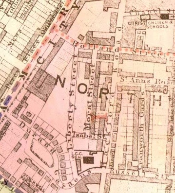
Southey Road can be seen here on this 1918 Ward Map, it is still called St Ann’s Road back then. It is remarkable to note how much the area has built up over the years, especially when scrolling up to the 1809 map when this entire space was empty.
1945
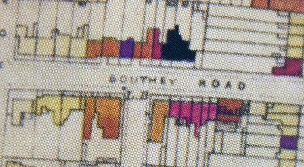
In September 1940 the government started to collect and collate information relating to damage sustained during bombing raids. Southey Road was hit on many occasions, you can see on the bomb map below that there was damage that varied from minor blast damage to total destruction. For more detail on how WW2 affected Southey Road and the Oval area in general see here.



Correction: Caldwell Gardens Estate predates 1960. We move into Creon Court in ’57.
I’ve always wondered about that funny little cul de sac that runs off Southey Rd